


|
|
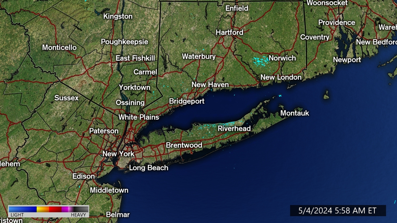
| Radar image courtesy of Accuweather | Click here for Live Webcams |
| Updated: @ 25-Jul-2026 7:25pm - next update at 7:00pm | |||||||||||||||||||||||||||||||||||||||||
| Summary / Temperature | Wind | Rain | Outlook | ||||||||||||||||||||||||||||||||||||||
|
|
|
|
||||||||||||||||||||||||||||||||||||||
| Humidity & Barometer | Almanac | Moon | |||||||||||||||||||||||||||||||||||||||
|
|
|
|||||||||||||||||||||||||||||||||||||||
| UV Index Forecast | UV Index Forecast | ||||||||||||||||||||||||||||||||||||||||
|
|
||||||||||||||||||||||||||||||||||||||||


| NWS Weather Forecast - Outlook: Tonight & Sunday | ||||||
|
||||||

Windy.com Wind Map
ABC Radar MAP
Forecast Details

NOAA Map

Convective Outlook

Water Vapor Atlantic

Surface Map

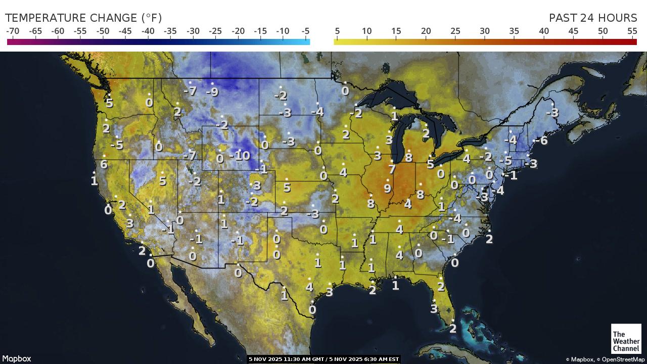
Current USA Temperature Change
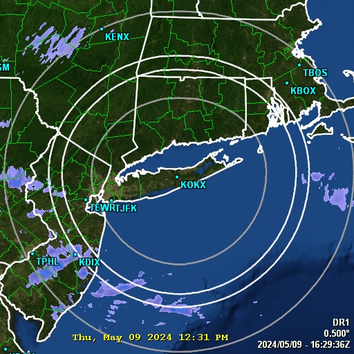
GR3 Radar
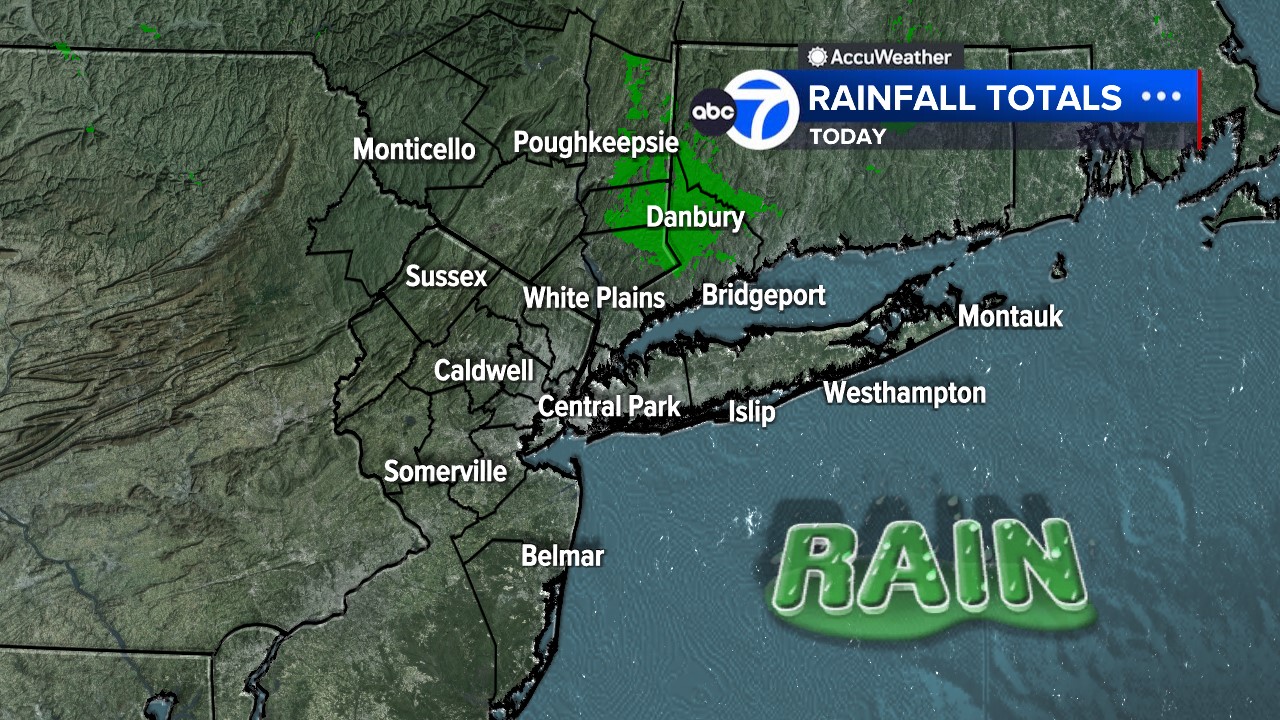
Rain Totals
Water Temp

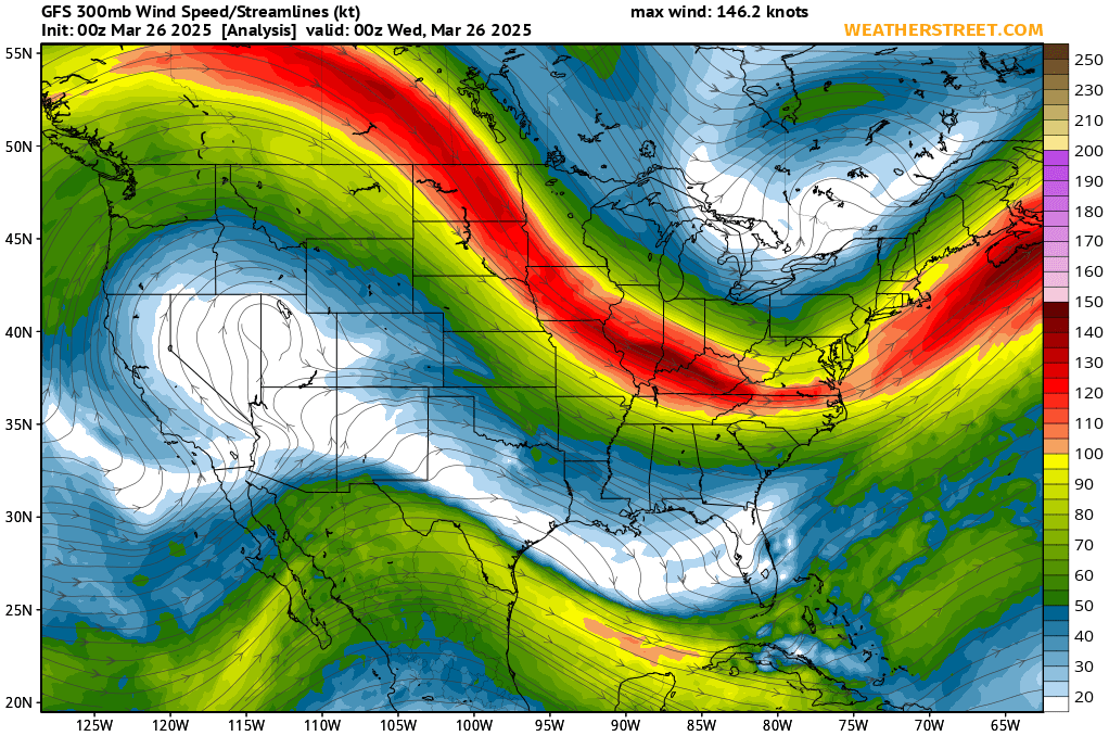
Jet Stream
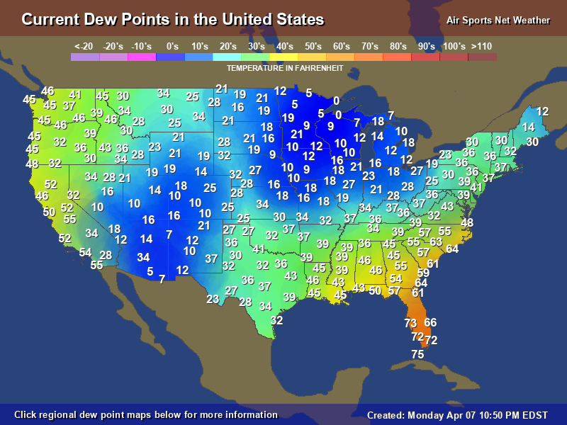
Dew Points
Satellite Imagery

No Weather Records Have Been Established For This Station Today as of 07/25/2026 7:25pm